Pincushion Mountain Overlook
Grand Marais
On January 3, 2026, Kim, Cash, and I hiked the portion of the Superior Hiking Trail from the Pincushion Mountain trailhead to the Pincushion Mountain Overlook. This was a fairly flat trail through a variety of habitats, including several winding boardwalks through cedar groves, until the spur up to the overlook. The views from the overlook were amazing. We looking forward to walking the trail further to the Devil Track River gorge in the future.
Walk-Specific Map
Take Note
- Click on a segment to get specific information.
- Numeric labels correspond to the same labels in the elevation profile and summary information below.
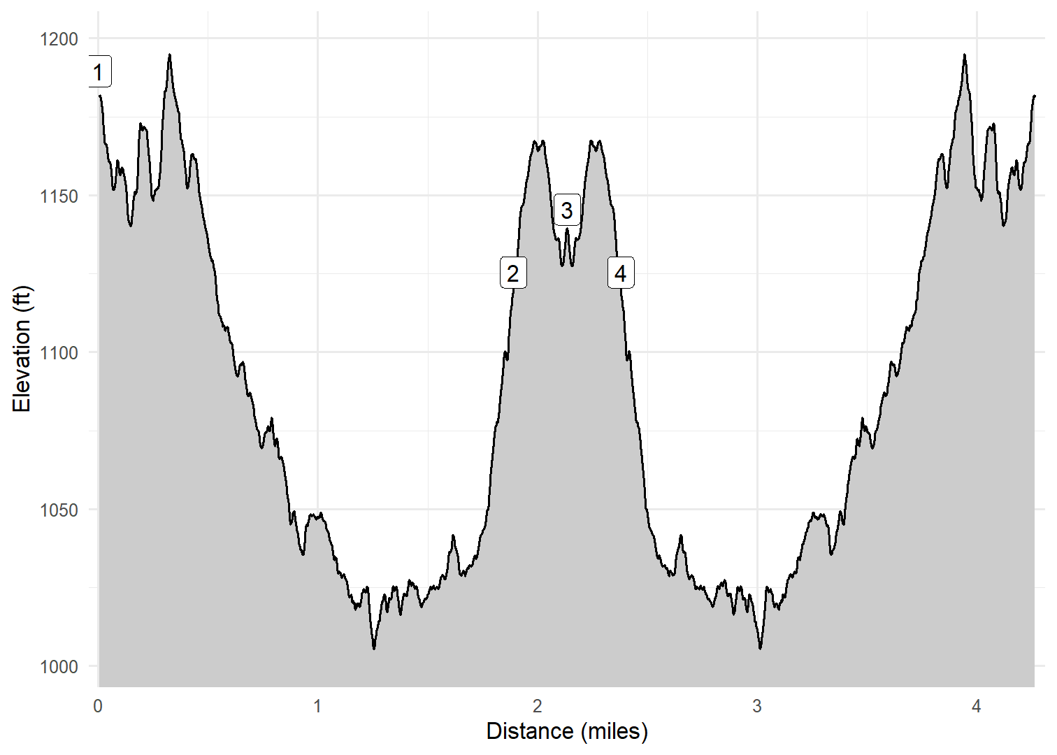
Elevation Profile
Images

MNPCSHN02: Kim and Cash on Pincushion Lookout

MNPCSHN02: View from Pincsushion Lookout

MNPCSHN02: Cash on Pincushion Lookout

MNPCSHN01: Kim and Cash on boardwalk
GPX Download
A sanitized GPX file of our hike is here.
Summary Information
| NUM | trackID | Primary | Description | Type | Distance | CumDist | DeltaElev |
|---|---|---|---|---|---|---|---|
| 1 | MNPCSHN01 | Pincushion Mountain Overlook | Parking lot to Spur to Overlook | Trail | 1.89 | 1.89 | -64 |
| 2 | MNPCSHN02 | Pincushion Mountain Overlook | Superior Hiking Tr to Overlook | Trail | 0.24 | 2.13 | 20 |
| 3 | MNPCSHN02 | Pincushion Mountain Overlook | Overlook to Superior Hiking Tr | Trail | 0.24 | 2.38 | -20 |
| 4 | MNPCSHN01 | Pincushion Mountain Overlook | Spur to Overlook to Parking lot | Trail | 1.89 | 4.27 | 64 |